Satellite Maps Reveal Who’s to Blame for the Sinking of Venice - Wired Science
Using two sets of satellite data, a team of scientists calculated how quickly Venice is sinking and how much of it can be blamed on nature, and how much on humans.
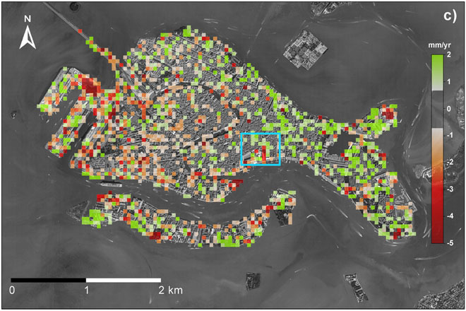
The scientists used radar imagery data collected by four different satellites and a relatively new analysis technique known as Persistent Scatterer Interferometry to make a much higher resolution calculation of the sinking than was previously possible. That might sound complicated, but the basic idea is actually pretty simple.
They conclude that the average background sinking is around 1 millimeter per year. The more acute man-made sinking ranged up to 10 millimeters a year (shown in red on the map above on the first slide), but in some places human activity actually reduces the natural sinking (shown in green).
More: Satellite Maps Reveal Who’s to Blame for the Sinking of Venice - Wired Science


