Shasta Lake, California : Image of the Day
The ongoing drought in the western United States is evident in the water levels of Shasta Lake, a large reservoir in northern California that counts on rainfall for replenishment. Low water levels can lead to hazardous conditions for local recreation. Many more people are affected by how this limited water resource is allocated for ecological, urban, and agricultural needs downstream.
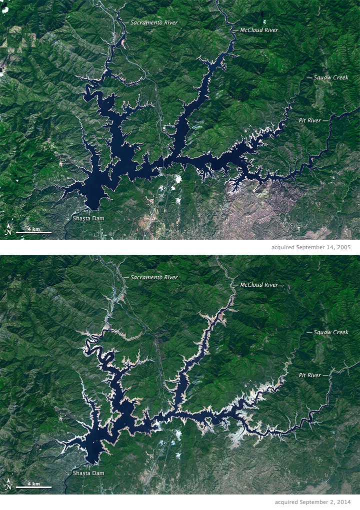
The Advanced Spaceborne Thermal Emission and Reflection Radiometer (ASTER) on Terra acquired these simulated true-color images of Shasta Lake. The top image shows the lake on September 14, 2005, and the bottom image was acquired on September 2, 2014.
On the day the first image was acquired, the lake’s elevation was 309.4 meters (1,015 feet); nine years later (second image), the lake level had dropped to an elevation of 278.3 meters (913 feet). The water elevation in the reservoir at full capacity would be 325.2 meters (1,067 feet). Light tan colors along the shore are new beach areas that have been uncovered as the water level has dropped. Click on the image comparison tool to see how the shoreline has changed.
The reservoir began to take shape in 1950 with the completion of Shasta Dam, visible in the lower left corner. At the time, it was the second-tallest concrete dam in the world, standing 183.5 meters (602 feet) high and 148.4 meters (487 feet) long. The dam traps water flowing from Squaw Creek and the McCloud, Pit, and Sacramento rivers, as well as smaller creeks and streams. Water released from the dam flows into a continuation of the Sacramento River and, ultimately, into the Sacramento-San Joaquin Delta and San Francisco Bay.


