The European Forecast Model Already Kicking America’s Butt Just Improved
The European forecast model already outperforms all of the world’s other global forecasting systems, including the North American GFS model. The most overt demonstration of the European model’s superiority came in the week before Hurricane Sandy’s devastating landfall in 2012. Out of more than a dozen computer forecasts, only it showed the storm veering along a path toward the East Coast of the United States instead of staying harmlessly out to sea.
Further ReadingWhy European forecasters saw Sandy’s path first
US weather model is good, but lags behind the best.
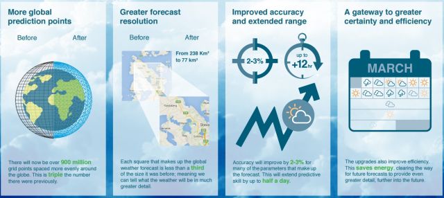
Now the world’s best forecast model is getting better, and not just by a little bit. An upgrade that went live this week provides dramatic improvements to the resolution of the model, both for its deterministic forecast as well as the ensemble model runs that are used for forecasting conditions a week or more in the future. “What the European modeling community is doing is just amazing,” Ryan Maue, a meteorologist with WeatherBell, told Ars. “This is the golden age of weather forecasters. It’s an absolute wonder of computer modeling technology.”
More: The European forecast model already kicking America’s butt just improved


