10 Years of Aqua Satellite’s Incredible Images of Earth From Space
The view of Earth from space has transformed our understanding of, as well as our admiration for, the planet. The data and images collected by Earth-observing satellites have been used in thousands of scientific papers, helped us better respond to natural disasters, improved weather and climate forecasts, enlightened us about our impact on Earth and captivated us with beauty.
One of the stars of NASA’s fleet of satellites is Aqua. The satellite is named for its ability to measure water vapor in the atmosphere, water in the oceans, as well as ice and snow. When it was launched on May 4, 2002, scientists expected it to work for three to five years. But its six instruments have been functioning perfectly for 10 years, gathering 29 million gigabytes of data in that time.
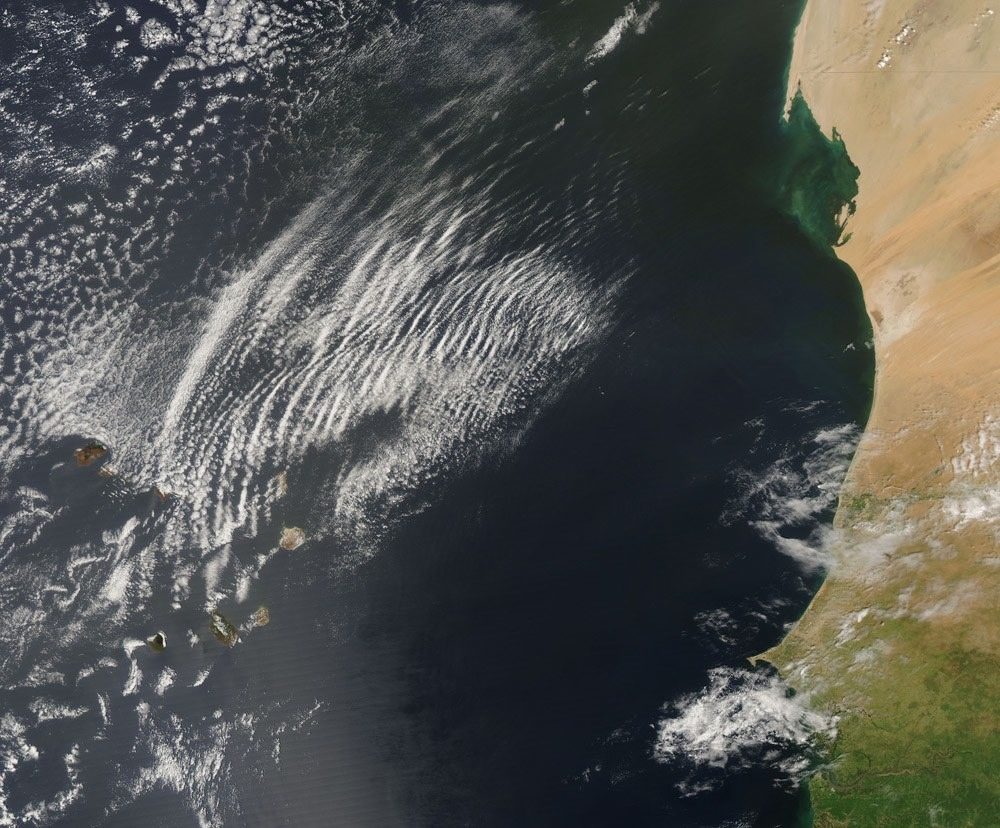 Known as wave clouds, these long, semicircular clouds were created by cool dry air coming from over Africa interacting with warm, humid air over the Atlantic Ocean. This image was captured by Aqua on Oct. 9, 2007
NASA has been pleasantly surprised with the performance of it’s Aqua satellite and we are lucky to have the amazing images it has captured over the last 10 years.


