Tonight’s Ian update has the projected track hitting Tampa Bay. Perhaps as a major hurricane, but it will be weakening upon landfall.
GFS currently has Ian actually lingering in the Bay for about a day.
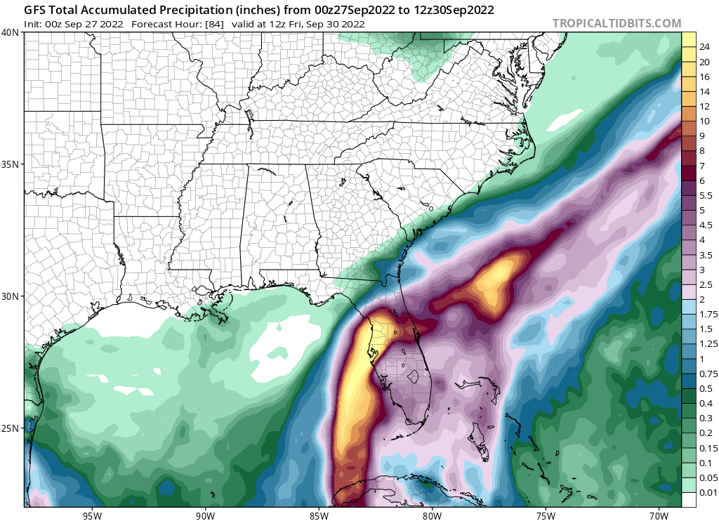
GFS accumulated precip through 12Z 30Sep:
But Ian will not be out of Florida by that time, not till the next day, but GFS current run doesn’t go past that time.
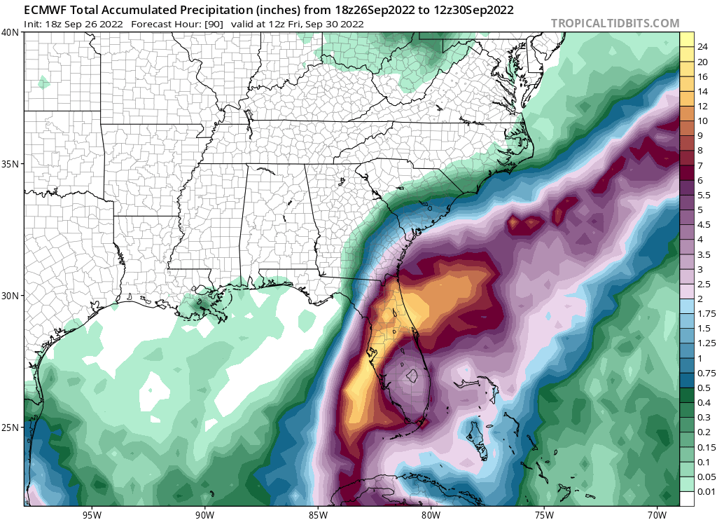
The European model has Ian making landfall a bit south of Tampa Bay, but moving through the state a bit quicker, turning more east at Tampa. However, it then stalls over the space coast before heading northward towards Jacksonville.
Euro model accumulate precip through 12Z 30Sep:
That’s a whole lotta rain.
If the Euro track comes true, it means Ian will hit Tampa then Orlando then Jacksonville, three of 4 of Florida’s major population centers.